These are very basic maps designed for a bit of navigational distraction on a training run maybe or as an intro to simple urban navigation. Unlike Permanent Orienteering Courses, there are no control markers when you get to the control points so you’ll just have to convince yourself you’re in the right place. (You’ll soon find out if you’re not as nothing will fit as you try to navigate away again!)
The maps are named after the start/finish points. In each case, the full course is approx. 6 km long (as the crow flies so actual running distance will be longer) with a suggested subset of controls to make a shorter version approx 4 km long. All distances very approximate and depends on how adventurous you get second guessing likely looking paths and cut throughs not shown on maps.
Map showing start/finish points for all Street O maps listed below.
1 Aberdeen Beach Leisure Centre shorter version 1 – 7, 13, 14
2 Duthie Park shorter version 1 – 4, 8 – 10
3 Westburn Park shorter version 1 – 7, 13, 14
4 St Machar Drive shorter version 1 – 8, 12
5 RGU Sports Centre shorter version 1 – 5, 10, 11
6 Johnstone Gardens shorter version 1 – 5/6
7 Kaimhill Road (Garthdee) shorter version 1 – 6, 11
8 Aberdeen Beach Leisure Centre very shorter version 1 – 6
9 Duthie Park shorter version 1-7, 11
10 Johnstone Gardens shorter version 1-3, 7-12
11 Ferryhill shorter version 1-4,9,10
12 Kingswells shorter version 1-6
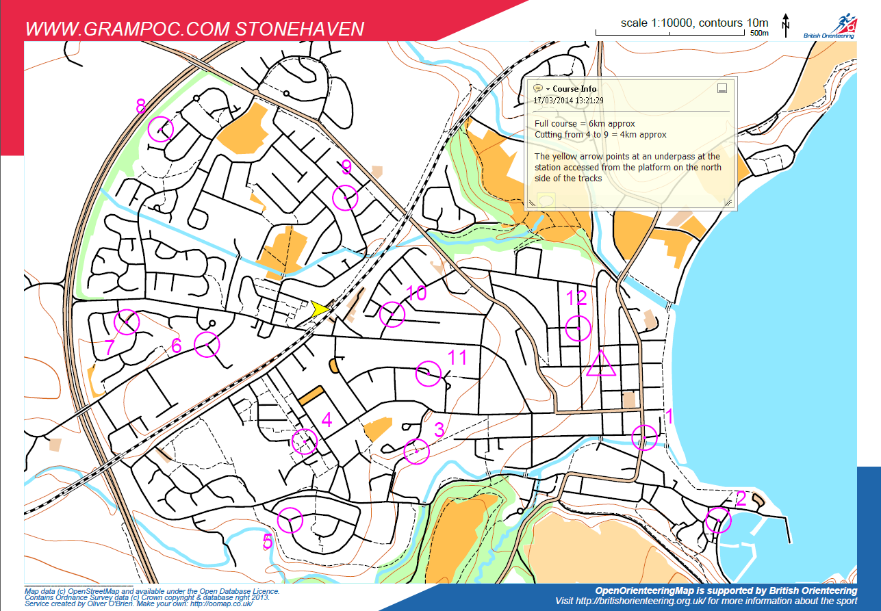
13 Stonehaven shorter version 1-4, 9-12
Have fun! Let us know how long you took if you timed yourself and we’ll publish those too so you can see how you compare. If you fancy having a go at making a map for yourself or for next year’s Street O series or to publish here, then have a play on http://oomap.co.uk/, all the brainchild of Oli O’Brien of SLOW.
